Water Park on the Pearl
Managed by Marion County, at 49 Dean Griner Drive — 601.736.7382. Boat ramp, disc golf, three lighted fields, and seven camper sites at $35 a night.

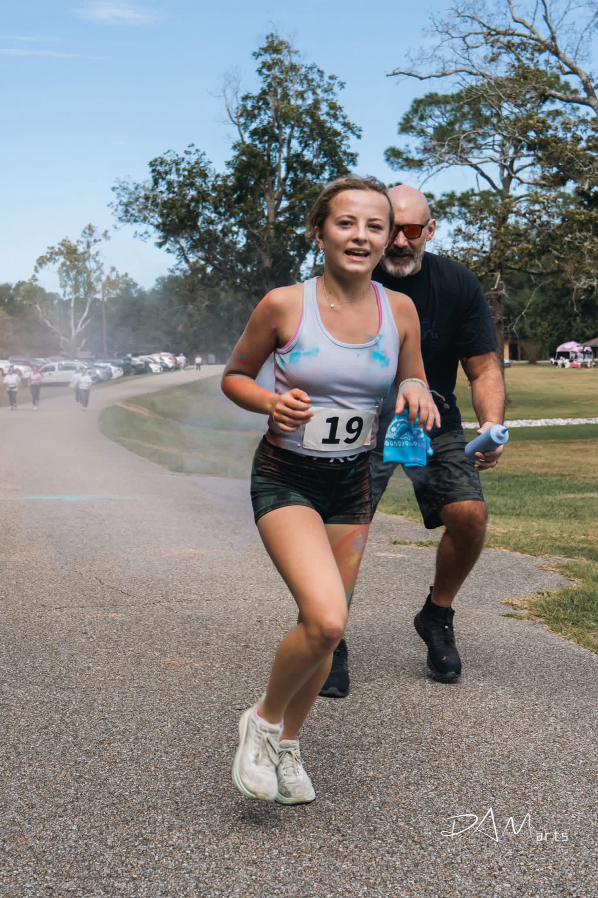
Colour run at the park. Photograph by RAM arts.
Parks & Recreation · Friendship Park · The Yards · the Pearl
An inclusive playground, six ball fields, two lakes and a river — all inside one small town.
Friendship Park
Friendship Park has been a Columbia park since 2002. On April 26, 2025 it opened again with something new: a $1.2 million inclusive playground, built so that a wheelchair, a walker, or a balance problem is not a reason to sit and watch.
A zip line. A merry-go-round. Swings, slides, and interactive games. And 100% poured-rubber and artificial-turf surfacing across the whole footprint — no pea gravel, no mulch, nothing that stops a wheel.
At the entrance is the Faces of Friendship Wall, where community members buy a photo square. The result is a town looking back at the kids who play there.
Since December 2025 the park has also carried the city's holiday celebration — "A Columbia Christmas at City Park."
Who paid for it
The largest gift to the playground — $650,000 — came from Columbia Strong, the nonprofit this town formed to answer the 2014 tornado. A decade after it organized to clean up after a disaster, it raised the money for a place to play.
The rest came in three more gifts: $300,000 from the Patrick F. Taylor Foundation, and $100,000 and $50,000 from two local businesses. Four gifts, $1.1 million, in a town of six thousand.
 The Yards
 The Yards
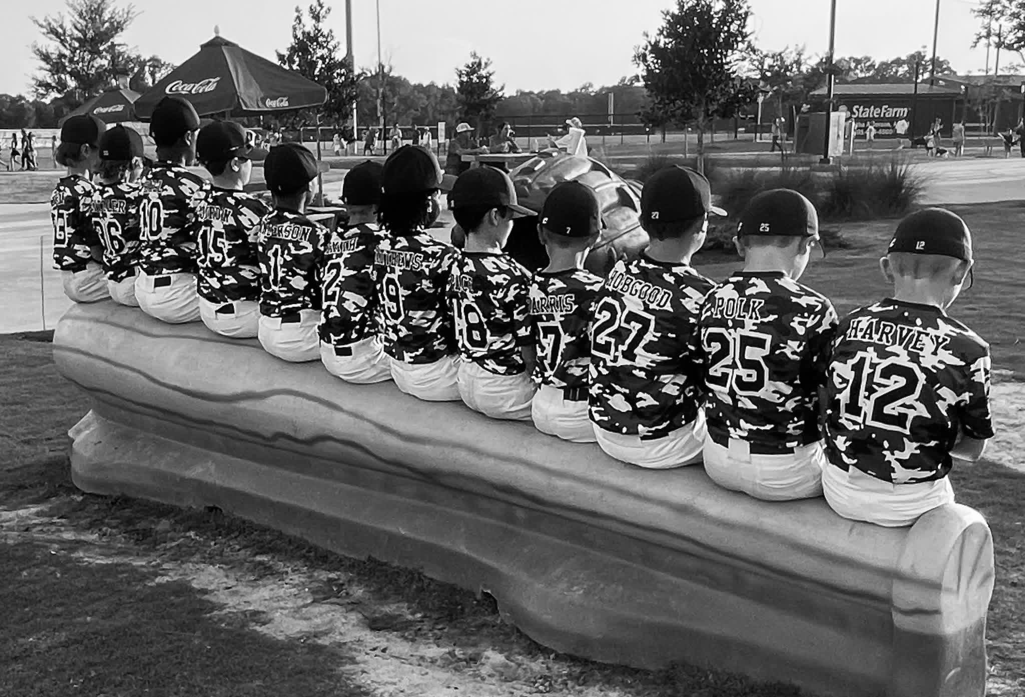
Opened in 2023 and funded by Columbia's tourism tax: six fields with covered seating on every one, batting cages, and a food-truck commons on R.A. Johnson Drive. At the gate stands It's Columbia, a bronze by Mississippi artist Ben Watts honoring the day two historically separate youth leagues became one league for every kid in town.
Phase two — soccer fields and tennis courts — broke ground in December 2024.
Photograph by RAM arts.
The rest of the map
Not everything green around Columbia is run by the city — and knowing who to call saves you a phone call.
Managed by Marion County, at 49 Dean Griner Drive — 601.736.7382. Boat ramp, disc golf, three lighted fields, and seven camper sites at $35 a night.
84 acres, and a state lake — managed by the Mississippi Department of Wildlife, Fisheries and Parks. A state lake permit is required. Lake manager: 601.736.1861.
168 acres of open water — the larger of the two lakes near town.
Downtown, with the river's whole course mapped into the concrete underfoot.
Seventeen holes, free to play.
The inclusive playground, the Faces of Friendship Wall, and the city's Christmas lights in December.
 A local peculiarity
 A local peculiarity
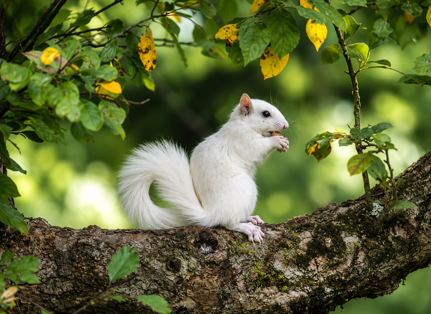
Columbia has white squirrels, and it has them on purpose. Gov. Hugh L. White — mayor here from 1926 until he went to Jackson — introduced them to the town, and their descendants never left. City Park is the usual place to see one.
If you spot one, you are not seeing things, and you are allowed to be pleased about it. Read how they got here.
Routed on the real street network
Both of these were run through a routing engine on the actual streets rather than measured off a map — which turned up something worth telling you before you set out.
About 65 minutes at a walking pace. This is the useful one, and it is beautifully simple:
Open the Errand Walk in Google Maps → — walking directions, North Columbia Baptist to Walmart.
Every foot of it is on a named street. What is on it is the point: a grocery, a dollar store, several pharmacies, fast food, several banks, the courthouse, City Hall, and the park. For anyone in Columbia without a car, that is most of a week's errands strung along one line you can actually walk.
About 50 minutes on a bike. From the Pearl River Interpretive Plaza: 2nd Street to Main, onto Broad, left on White Street, right onto Church Street and out until it becomes Briarwood Drive. Briarwood to Old Highway 98 East and along it past Chapel of the Cross and Woodlawn. Back via Columbia Purvis Road, West Payton Road and Sumrall Road, then the long run down Broad Street, and home by South High School Avenue, South Main and 2nd Street.
🔴 Ride this one — don't walk it. When we routed it, about a third of the distance — 3.2 of the 9.6 miles — runs on stretches with no street name at all: highway frontage, shoulder, and connector pavement along the Highway 98 section. That is unremarkable on a bicycle and genuinely unpleasant on foot, and in places there is no sidewalk to be on.
Open the Loop in Google Maps → — cycling directions for the full circuit, back to the plaza. (If you insist on walking it, here it is on foot — but read the caveat above first.)
It is billed as the ten-mile loop and measures 9.6. Adding the Park Avenue leg on the way back makes it a true 10.9 if you want the number to be honest in the other direction.
Next step on this: getting the safe crossings marked, particularly where the loop meets Highway 98. If you ride or walk a better line, tell us — local knowledge beats a routing engine on exactly this kind of thing.
Eight neighborhood loops
Not everyone wants a ten-mile ride. These are loops — they bring you back where you started — routed on real streets and measured, so the mileage is the mileage.
Every one has a Google Maps link. Tap it on your phone and it opens walking directions for the whole loop, ready to navigate. The route is built as a circuit, so it will bring you home rather than leave you somewhere across town.
0.95 mi — from Courthouse. Broad Street → High School Avenue → Church Street → Oak Avenue → Broad Street. Open in Google Maps →
1.07 mi — from City Hall. 2nd Street → High School Avenue → Dale Street → Jackson Avenue → Church Street → Main Street → 2nd Street. Open in Google Maps →
2.19 mi — from North Columbia Baptist. North Main Street → Hawkins Avenue → 3rd Street → Mayson Avenue → North Main Street. Open in Google Maps →
3.07 mi — from North Columbia Baptist. North Main Street → Lafayette Street → High School Avenue → Dale Street → Jackson Avenue → Church Street → Main Street → North Main Street. Open in Google Maps →
A note on the links. Google will pick its own way between the corners, so it may differ from the street list by a turn here and there — the distance and the shape hold. On a phone, tap the link, then Start.
These deliberately avoid a few streets. If a route sends you somewhere that doesn't feel right on foot — bad crossing, no sidewalk, dogs — tell us and we'll re-route it. That's the kind of thing only people who walk it know.
Parks & Recreation
Parks and Recreation and The Yards are on R.A. Johnson Drive. Ask for Interim Director Will Jordan. For anything else — a field, a park, a question — City Hall answers at 601.736.8201.